 |
|
Desaru
ship |
19 July 2003
|
|||
| Last modified: 19 July 2003 |
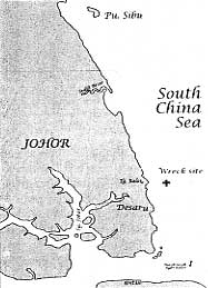 The ship lies close to shore, and could have been destined for Singapore, Melaka, or Indonesia. |
 |
The wreck site is two nautical miles off Desaru beach, on the east coast of Johor in the south of Peninsular Malaysia. The wreck was buried one metre below a muddy seabed, at a depth of twenty metres. Due to a thick layer of silt deposited by nearby river outlets, underwater visibility was limited. During the surface investigation, visibility was zero at high tide and a maximum 1.5 metres at low water. Tidal current varied between 1.1 and 2.5 knots. The current is predominantly in the direction 150 degrees, away from the river outlets.
Winds in the South China Sea are mainly generated by two monsoons. The stronger of the two, the northeasterly, prevails between mid-November and early March. The 'southwest' monsoon, which is actually southeasterly in this southern region, blows between July and September. The two transitional periods, April-May and October-November, are characterised by light and variable winds, interspersed with calms and short-but-violent storms.
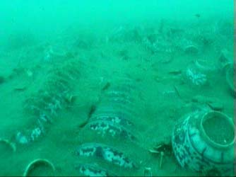
The site when discovered was level with the surrounding seabed, without any protruding wood or pottery, but with scattered pottery shards littering a large area of the surface. The usual mound of pottery, which could have represented as much as thirty percent of the cargo, was shaved flat. The top edge of a few transverse bulkheads were seen level with the seabed. These were 1.55 metres apart, indicating that this was the standard distance between individual cargo compartments. However, in one such compartment an additional bulkhead was found. This was believed to be the mast area, with an additional bulkhead inserted for extra strength. After light hand fanning, a short section of a hull and transverse bulkhead planks became visible.
The site is aligned 30-210 degrees, with the apparent bow pointing 30 degrees. The scattered shards are found up to 4 metres either side of the ship, and up to 20 metres to the north and south, along the trawling directions.
Ceramics found in the port bow area were more broken and disorganized than in other sections of the ship. The hull has a slight list to port, so more of the hull planks survive on the port side than on the starboard. No other cause of sinking was evident, so the hypothesis is that the port bow was first to hit the bottom.
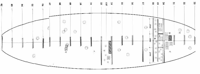 Plan of the site during surface investigation, with limited structure and cargo visible. |
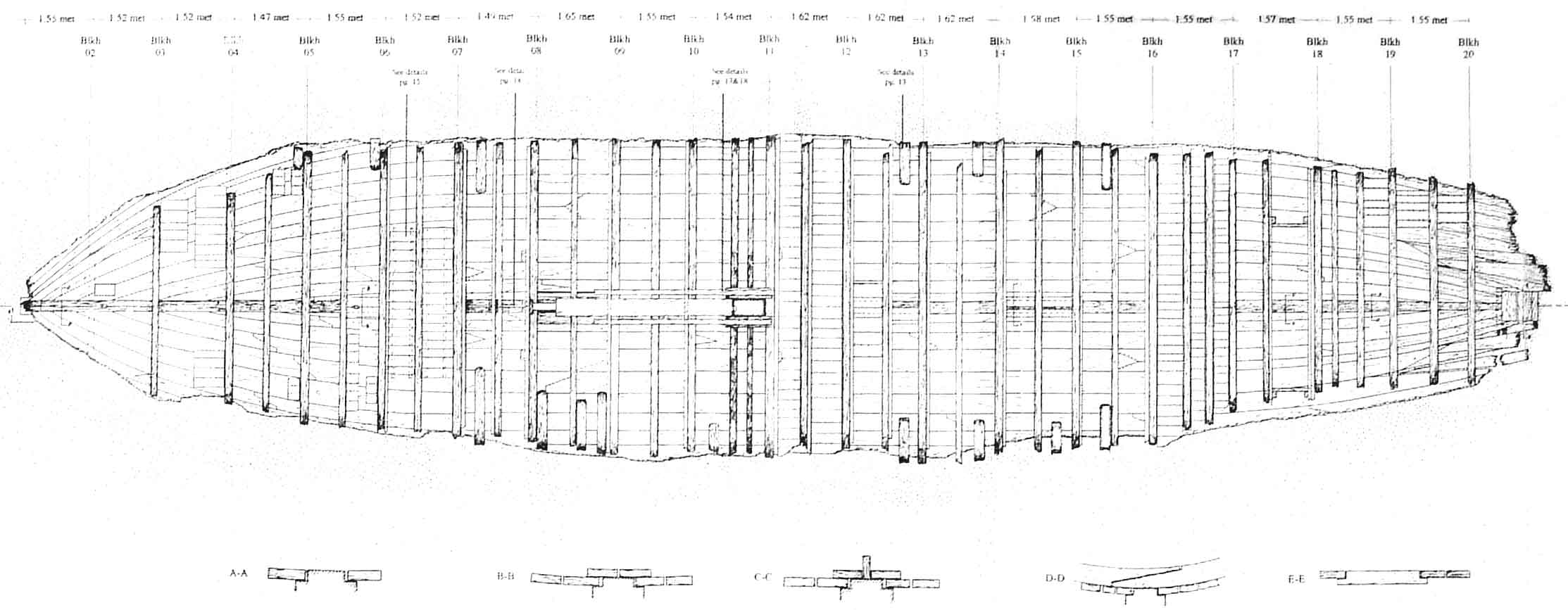 Site plan after excavation. |
Fishermen were key to locating the wreck, but trawl nets have caused significant damage to this and other sites.
The Desaru shipwreck was discovered in May 2001. Initial information came from a bottom trawler, which twice snagged its nets, and in them found a few pottery shards and one piece of ship's timber. The position provided was imprecise, but a local fisherman was able to point out three spots where he had snagged his drift net. While moving about the area to obtain his locations, a few spots with fish were noticed on the depth sounder. Fish are often attracted to wreck sites, and one of these spots was indeed part of the wreck. The discovery was timely, as the site had already been damaged by bottom trawlers, and might soon have become undetectable using today's technology.
The timing of work on the site was dependent on necessary official approvals, as well as on the seasons. A surface investigation was conducted in June 2001; the ship's cargo was recovered in Oct-Nov 2001; and site measurements and mapping continued during April, May and September 2002. Returning to the site in early April 2002, it was found littered with broken planks and misplaced bulkhead frames. The official buoy requested to protect the site was first installed on 13 Dec 2001, a full month after the first recovery season ended; meanwhile trawlers had been active. Missing bulkhead planks showed that the site had been damaged after the recovery phase and before the buoy was in place. Newly deposited sand and mud, again level with the surrounding seafloor, was higher than the missing planks. Further damage to the site occurred between May and September 2002, despite a marker buoy close to the wreck. On returning to the site for final measurements, a long steel chain and parts of a trawl net were found stuck in the ship's timbers. Three large and heavy longitudinal beams belonging to the mast support had vanished altogether.
| Desaru ship overview | Maritime Asia homepage | Next: the ship's structure |